Pulsar consulting tudor ivanov
14
www.parking-guidance.com A PULSAR CONSULTING software www.pulsar.be Smart Mobility in Smart Cities : Parking and Traffic Guidance in Open Data context
-
Upload
agoria -
Category
Technology
-
view
34 -
download
2
Transcript of Pulsar consulting tudor ivanov

www.parking-guidance.com A PULSAR CONSULTING software www.pulsar.be
Smart Mobility in Smart Cities : Parking and Traffic Guidance in Open Data context
www.parking-guidance.com A PULSAR CONSULTING software www.pulsar.be
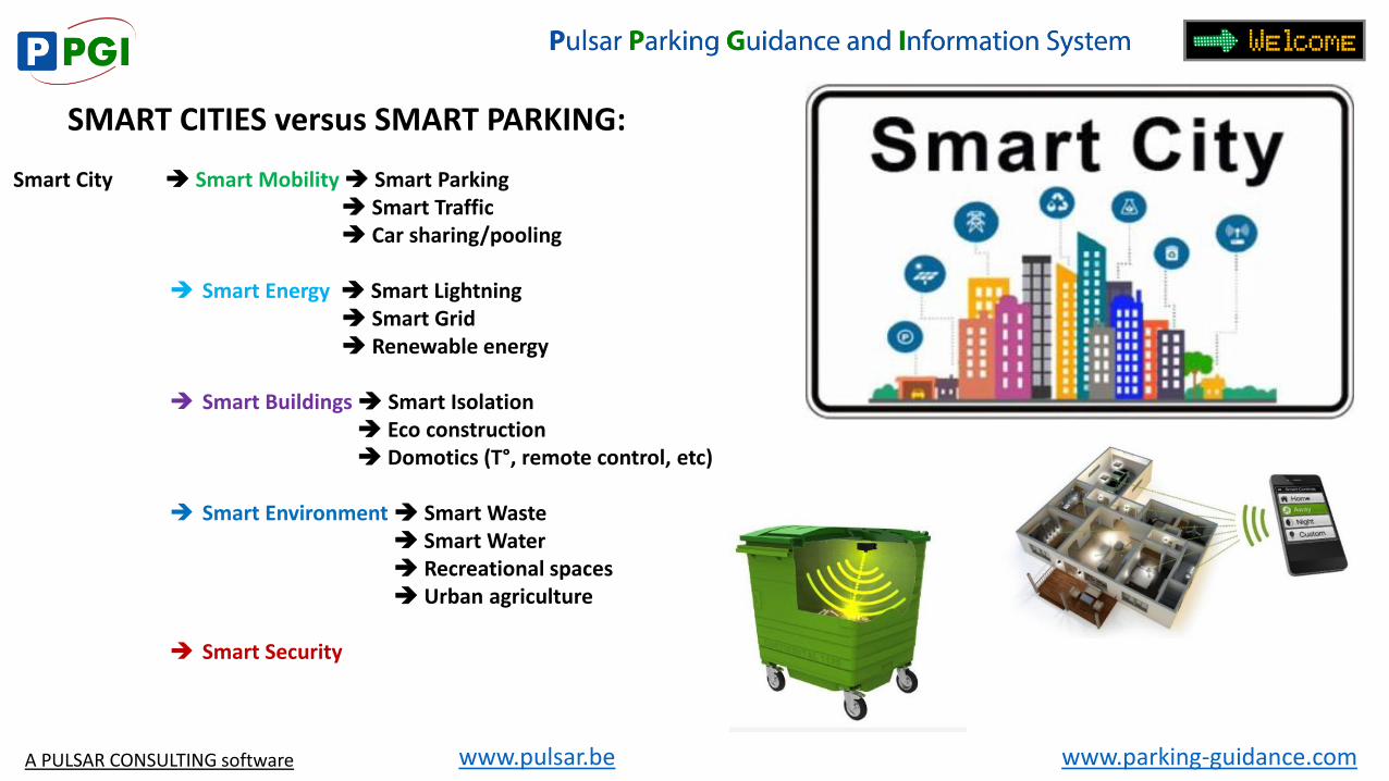
SMART CITIES versus SMART PARKING:
Smart City Smart Mobility Smart Parking Smart Traffic Car sharing/pooling
Smart Energy Smart Lightning Smart Grid Renewable energy
Smart Buildings Smart Isolation Eco construction Domotics (T°, remote control, etc)
Smart Environment Smart Waste Smart Water Recreational spaces Urban agriculture
Smart Security
www.parking-guidance.com www.pulsar.be
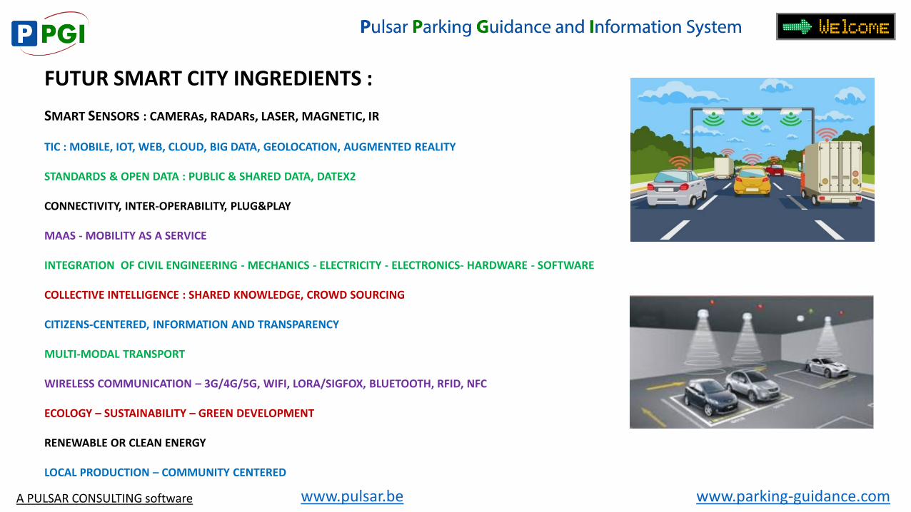
FUTUR SMART CITY INGREDIENTS :
SMART SENSORS : CAMERAs, RADARs, LASER, MAGNETIC, IR TIC : MOBILE, IOT, WEB, CLOUD, BIG DATA, GEOLOCATION, AUGMENTED REALITY STANDARDS & OPEN DATA : PUBLIC & SHARED DATA, DATEX2 CONNECTIVITY, INTER-OPERABILITY, PLUG&PLAY MAAS - MOBILITY AS A SERVICE INTEGRATION OF CIVIL ENGINEERING - MECHANICS - ELECTRICITY - ELECTRONICS- HARDWARE - SOFTWARE COLLECTIVE INTELLIGENCE : SHARED KNOWLEDGE, CROWD SOURCING CITIZENS-CENTERED, INFORMATION AND TRANSPARENCY MULTI-MODAL TRANSPORT WIRELESS COMMUNICATION – 3G/4G/5G, WIFI, LORA/SIGFOX, BLUETOOTH, RFID, NFC ECOLOGY – SUSTAINABILITY – GREEN DEVELOPMENT RENEWABLE OR CLEAN ENERGY LOCAL PRODUCTION – COMMUNITY CENTERED
A PULSAR CONSULTING software
www.parking-guidance.com www.pulsar.be
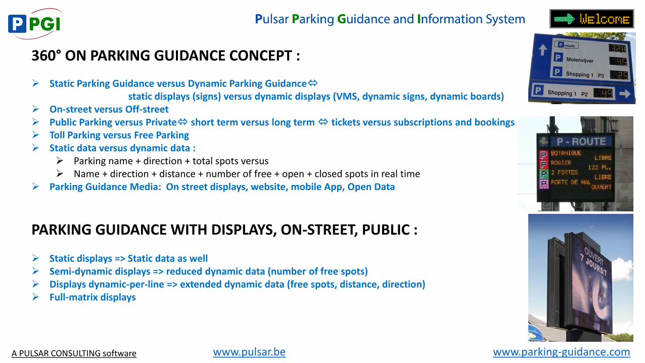
360° ON PARKING GUIDANCE CONCEPT :
Static Parking Guidance versus Dynamic Parking Guidance static displays (signs) versus dynamic displays (VMS, dynamic signs, dynamic boards) On-street versus Off-street Public Parking versus Private short term versus long term tickets versus subscriptions and bookings Toll Parking versus Free Parking Static data versus dynamic data :
Parking name + direction + total spots versus Name + direction + distance + number of free + open + closed spots in real time
Parking Guidance Media: On street displays, website, mobile App, Open Data
PARKING GUIDANCE WITH DISPLAYS, ON-STREET, PUBLIC :
Static displays => Static data as well Semi-dynamic displays => reduced dynamic data (number of free spots) Displays dynamic-per-line => extended dynamic data (free spots, distance, direction) Full-matrix displays
A PULSAR CONSULTING software
www.parking-guidance.com www.pulsar.be
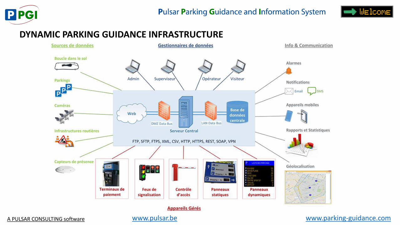
DYNAMIC PARKING GUIDANCE INFRASTRUCTURE
A PULSAR CONSULTING software
www.parking-guidance.com www.pulsar.be
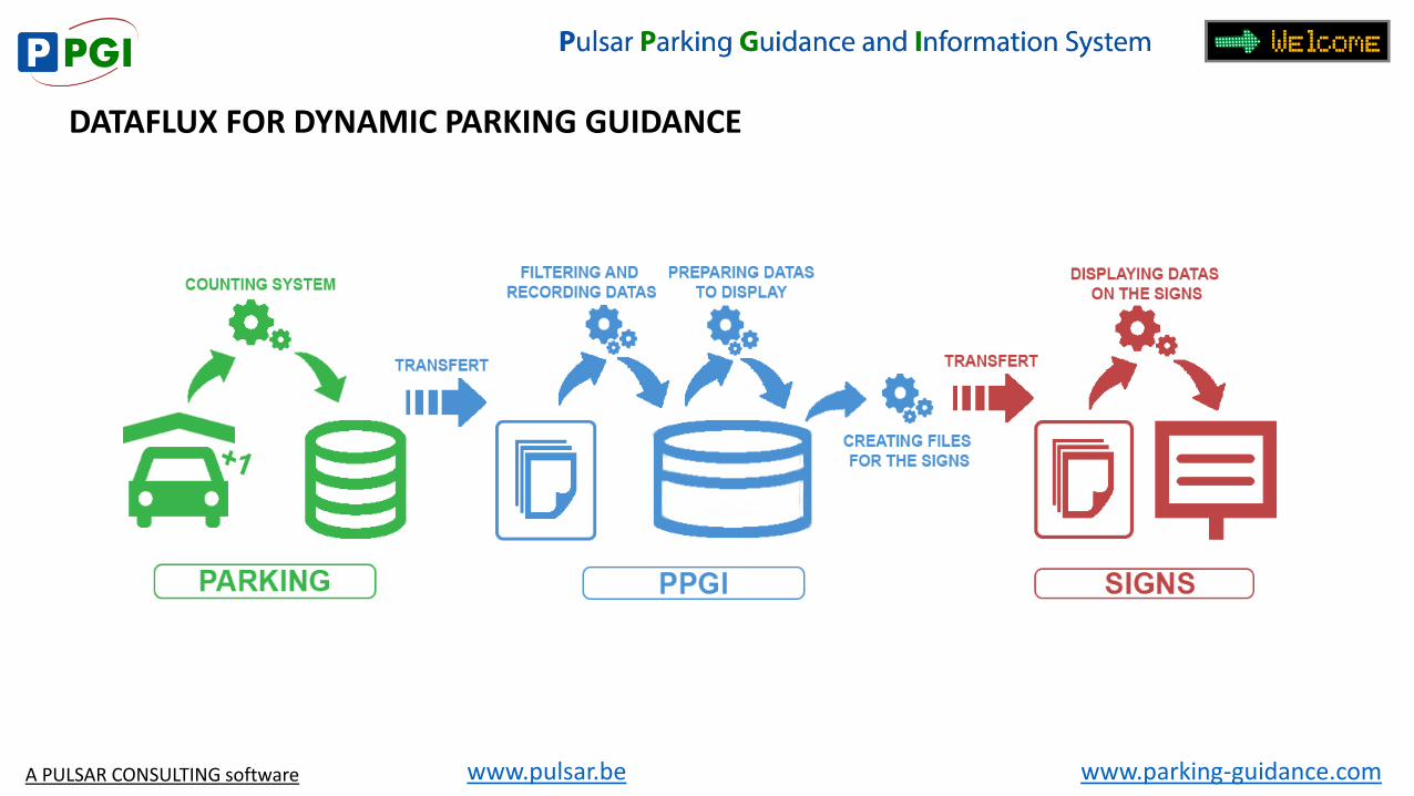
DATAFLUX FOR DYNAMIC PARKING GUIDANCE
A PULSAR CONSULTING software
www.parking-guidance.com www.pulsar.be
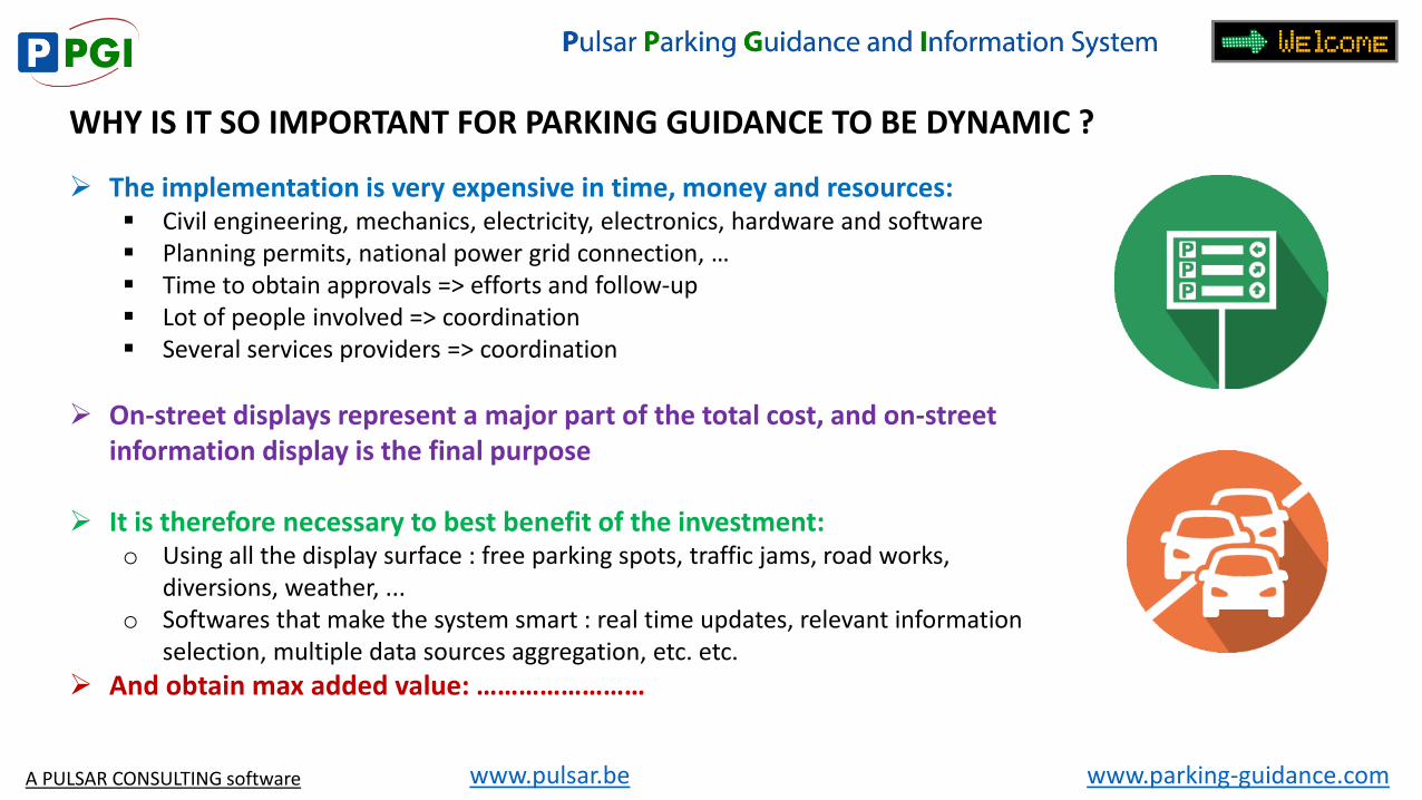
WHY IS IT SO IMPORTANT FOR PARKING GUIDANCE TO BE DYNAMIC ?
The implementation is very expensive in time, money and resources: Civil engineering, mechanics, electricity, electronics, hardware and software Planning permits, national power grid connection, … Time to obtain approvals => efforts and follow-up Lot of people involved => coordination Several services providers => coordination
On-street displays represent a major part of the total cost, and on-street information display is the final purpose
It is therefore necessary to best benefit of the investment: o Using all the display surface : free parking spots, traffic jams, road works,
diversions, weather, ... o Softwares that make the system smart : real time updates, relevant information
selection, multiple data sources aggregation, etc. etc.
And obtain max added value: ……………………
A PULSAR CONSULTING software
www.parking-guidance.com www.pulsar.be
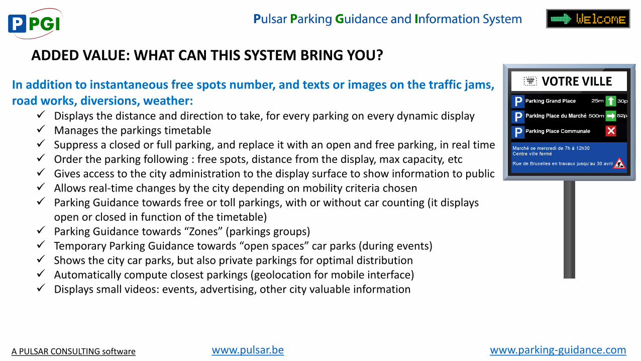
ADDED VALUE: WHAT CAN THIS SYSTEM BRING YOU?
In addition to instantaneous free spots number, and texts or images on the traffic jams, road works, diversions, weather:
Displays the distance and direction to take, for every parking on every dynamic display Manages the parkings timetable Suppress a closed or full parking, and replace it with an open and free parking, in real time Order the parking following : free spots, distance from the display, max capacity, etc Gives access to the city administration to the display surface to show information to public Allows real-time changes by the city depending on mobility criteria chosen Parking Guidance towards free or toll parkings, with or without car counting (it displays
open or closed in function of the timetable) Parking Guidance towards “Zones” (parkings groups) Temporary Parking Guidance towards “open spaces” car parks (during events) Shows the city car parks, but also private parkings for optimal distribution Automatically compute closest parkings (geolocation for mobile interface) Displays small videos: events, advertising, other city valuable information
A PULSAR CONSULTING software
www.parking-guidance.com www.pulsar.be
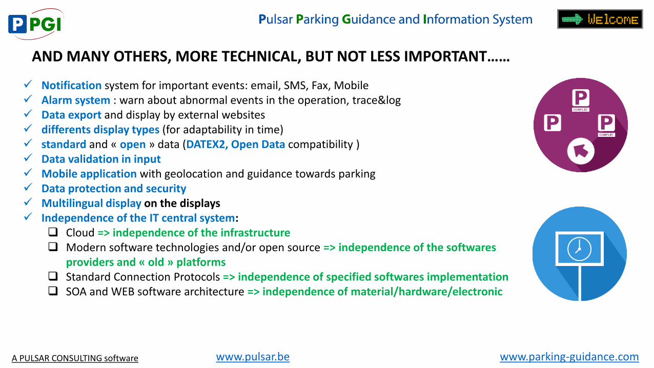
AND MANY OTHERS, MORE TECHNICAL, BUT NOT LESS IMPORTANT……
Notification system for important events: email, SMS, Fax, Mobile Alarm system : warn about abnormal events in the operation, trace&log Data export and display by external websites differents display types (for adaptability in time) standard and « open » data (DATEX2, Open Data compatibility ) Data validation in input Mobile application with geolocation and guidance towards parking Data protection and security Multilingual display on the displays Independence of the IT central system:
Cloud => independence of the infrastructure Modern software technologies and/or open source => independence of the softwares
providers and « old » platforms Standard Connection Protocols => independence of specified softwares implementation SOA and WEB software architecture => independence of material/hardware/electronic
A PULSAR CONSULTING software
www.parking-guidance.com www.pulsar.be
AT EUROPEAN LEVEL
European directive (2010/40/UE, 7 july 2010) to accelerate ITS deployments in Europe: Legal obligation for the 3 regions to draw up an ITS action plan and submit it to the
European Commission every 3 years.
Delegated regulations for the establishment of European standards, particularly concerning the data exchange:
Open and inter-operable format at European level, and according to specific standards (DATEX II for traffic management data for example)
EU imposes to “massively” invest in ITS via Delegated Acts (DA), eg….
A PULSAR CONSULTING software
www.parking-guidance.com www.pulsar.be
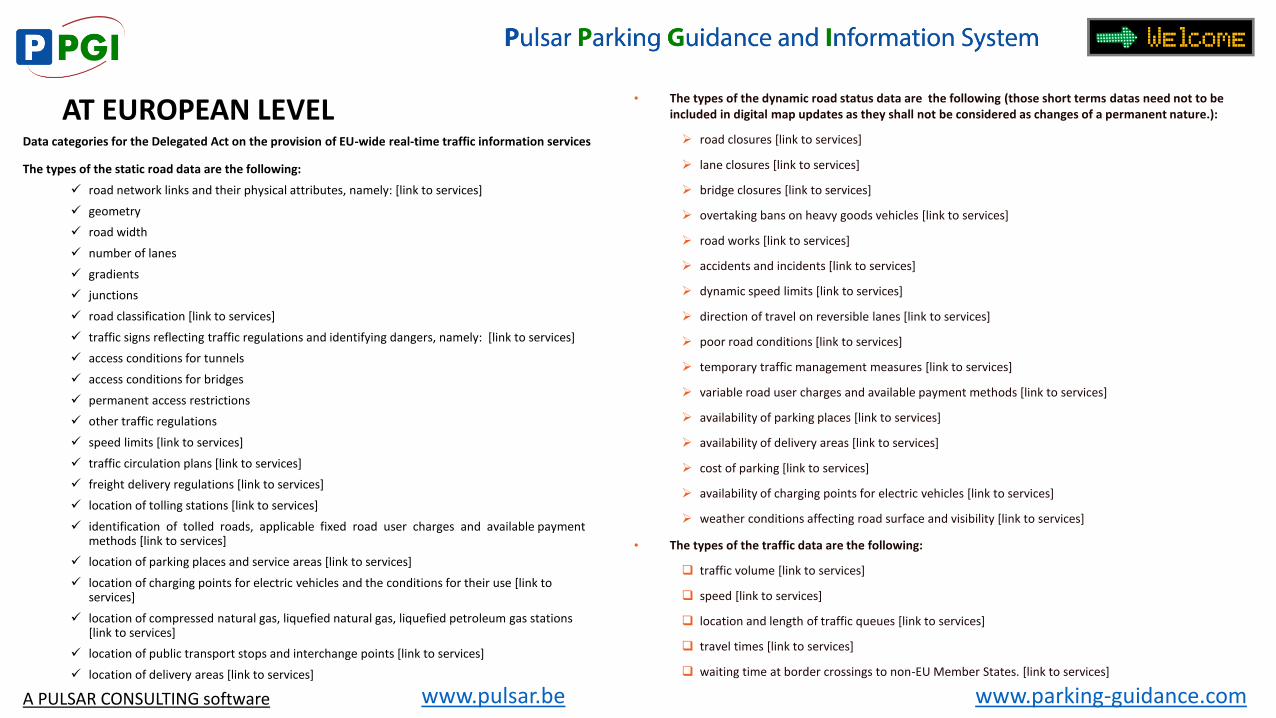
AT EUROPEAN LEVEL Data categories for the Delegated Act on the provision of EU-wide real-time traffic information services
The types of the static road data are the following:
road network links and their physical attributes, namely: [link to services]
geometry
road width
number of lanes
gradients
junctions
road classification [link to services]
traffic signs reflecting traffic regulations and identifying dangers, namely: [link to services]
access conditions for tunnels
access conditions for bridges
permanent access restrictions
other traffic regulations
speed limits [link to services]
traffic circulation plans [link to services]
freight delivery regulations [link to services]
location of tolling stations [link to services]
identification of tolled roads, applicable fixed road user charges and available payment methods [link to services]
location of parking places and service areas [link to services]
location of charging points for electric vehicles and the conditions for their use [link to services]
location of compressed natural gas, liquefied natural gas, liquefied petroleum gas stations [link to services]
location of public transport stops and interchange points [link to services]
location of delivery areas [link to services]
• The types of the dynamic road status data are the following (those short terms datas need not to be included in digital map updates as they shall not be considered as changes of a permanent nature.):
road closures [link to services]
lane closures [link to services]
bridge closures [link to services]
overtaking bans on heavy goods vehicles [link to services]
road works [link to services]
accidents and incidents [link to services]
dynamic speed limits [link to services]
direction of travel on reversible lanes [link to services]
poor road conditions [link to services]
temporary traffic management measures [link to services]
variable road user charges and available payment methods [link to services]
availability of parking places [link to services]
availability of delivery areas [link to services]
cost of parking [link to services]
availability of charging points for electric vehicles [link to services]
weather conditions affecting road surface and visibility [link to services]
• The types of the traffic data are the following:
traffic volume [link to services]
speed [link to services]
location and length of traffic queues [link to services]
travel times [link to services]
waiting time at border crossings to non-EU Member States. [link to services]
A PULSAR CONSULTING software
www.parking-guidance.com www.pulsar.be
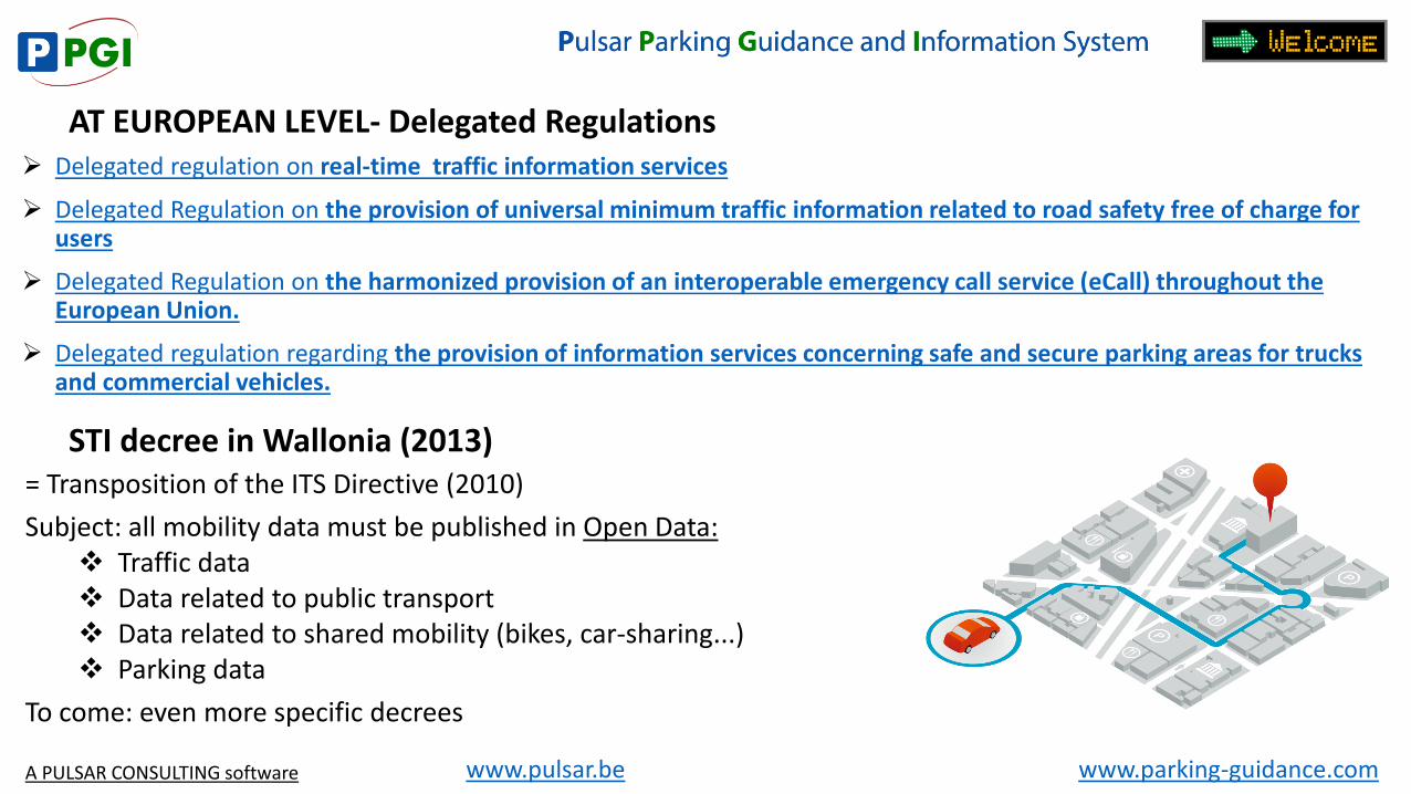
AT EUROPEAN LEVEL- Delegated Regulations Delegated regulation on real-time traffic information services
Delegated Regulation on the provision of universal minimum traffic information related to road safety free of charge for users
Delegated Regulation on the harmonized provision of an interoperable emergency call service (eCall) throughout the European Union.
Delegated regulation regarding the provision of information services concerning safe and secure parking areas for trucks and commercial vehicles.
STI decree in Wallonia (2013) = Transposition of the ITS Directive (2010)
Subject: all mobility data must be published in Open Data: Traffic data Data related to public transport Data related to shared mobility (bikes, car-sharing...) Parking data
To come: even more specific decrees
A PULSAR CONSULTING software
www.parking-guidance.com www.pulsar.be
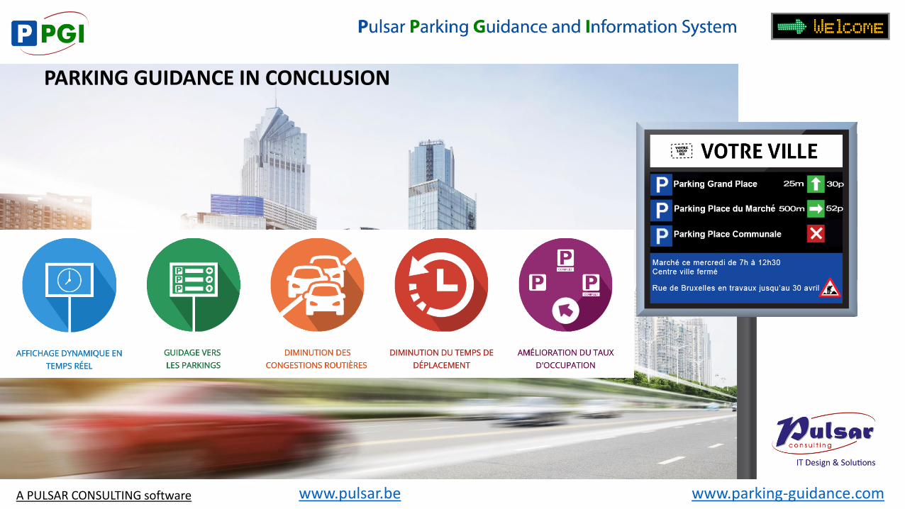
PARKING GUIDANCE IN CONCLUSION
A PULSAR CONSULTING software

www.parking-guidance.com www.pulsar.be
QUESTIONS AND ANSWERS
Thank you! Tudor IVANOV [email protected] +32 477 61 80 20
A PULSAR CONSULTING software